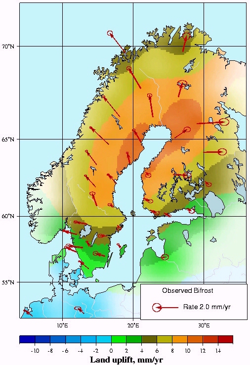
The detected motion appears clearly related to the rebound of Fennoscandia, the isostatic relaxation that still going on since the waning of the latest ice sheet about 10,000 years ago.
The unique features of the GPS data are, that motion is related to the gravity centre of the earth, rather than a mean sea level or another height datum. More specifically, the motion is observed in an International Terrestrial Reference Frame.
By comparison with tide gauge observations of relavtive sea level, the land motion can be inferred and thus the absolute change of the sea level is retained.
For the first time, a clear pattern of horizontal motion emerges. At the relatively small scale of a few millimeters per year over thousand kilometer distance, this horizontal deformation has not been accessible to geodetic observation before.
Links to our partners
Space Geodesy at Harvard-Smithsonian Center for Astrophysics
.
SWEPOS at National Land Survey of Sweden
.
Geodesy and Geodynamics at Finnish Geodetic Institute